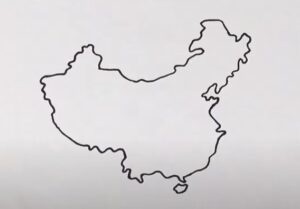
How to draw China (map) Step by Step - How to draw China (map) with this how-to video and step by step drawing instructions. Easy map drawing tutorial for beginners and all. Please see china drawing tutorial in the video below You can refer to china simple step by step drawing guide below Materials: Gather paper, a pencil, an - https://htdraw.com/wp-content/uploads/2024/02/How-to-draw-China.jpg - https://htdraw.com/how-to-draw-china-map-step-by-step/
How to draw China (map) with this how-to video and step by step drawing instructions. Easy map drawing tutorial for beginners and all.

Gather paper, a pencil, an eraser, and optional colored pencils or markers.
Begin by sketching a rough outline of China's overall shape. It roughly resembles a chicken facing west. Remember to include the distinctive shapes of its borders, including the jagged coastline, the border with Mongolia to the north, and its borders with neighboring countries such as Russia, India, and Myanmar.
Add detail to the coastline, noting the prominent features such as the Bohai Sea, Yellow Sea, East China Sea, and South China Sea. Pay attention to the intricate shape of the coastline, including peninsulas like Shandong and Liaodong.
China is divided into provinces, autonomous regions, and municipalities. Start by drawing the borders of major provinces like Hebei, Shanxi, Henan, and Jiangsu. Also, outline autonomous regions like Tibet and Xinjiang.
Add major cities such as Beijing, Shanghai, Guangzhou, and Chengdu. You can mark them with dots or small circles and label them accordingly.
Sketch the routes of major rivers such as the Yellow River (Huang He), Yangtze River (Chang Jiang), and Pearl River (Zhu Jiang). Additionally, draw significant lakes like Lake Taihu and Dongting Lake.
Outline prominent mountain ranges like the Himalayas in the southwest, the Kunlun Mountains in the west, and the Qinling Mountains in central China. Pay attention to the topography of China, as it greatly influences its geography.
Draw the borders of China with neighboring countries such as Mongolia, Russia, India, Pakistan, Nepal, Bhutan, Myanmar, Laos, and Vietnam.
Label the different regions of China, major cities, rivers, and other features if desired. You can use colored pencils or markers to add color to the map, such as blue for water bodies and green for land.
Review your map, add any necessary details or corrections, and finalize the lines and labels.
Once you're satisfied with the map, go over the outlines with a darker pencil or pen to make them stand out, and erase any unnecessary lines.
- https://htdraw.com/wp-content/uploads/2024/02/How-to-draw-China.jpg - https://htdraw.com/how-to-draw-china-map-step-by-step/

Please see china drawing tutorial in the video below
You can refer to china simple step by step drawing guide below
Materials:
Gather paper, a pencil, an eraser, and optional colored pencils or markers.
Outline the Basic Shape:
Begin by sketching a rough outline of China's overall shape. It roughly resembles a chicken facing west. Remember to include the distinctive shapes of its borders, including the jagged coastline, the border with Mongolia to the north, and its borders with neighboring countries such as Russia, India, and Myanmar.
Draw the Coastline:
Add detail to the coastline, noting the prominent features such as the Bohai Sea, Yellow Sea, East China Sea, and South China Sea. Pay attention to the intricate shape of the coastline, including peninsulas like Shandong and Liaodong.
Outline Provinces and Autonomous Regions:
China is divided into provinces, autonomous regions, and municipalities. Start by drawing the borders of major provinces like Hebei, Shanxi, Henan, and Jiangsu. Also, outline autonomous regions like Tibet and Xinjiang.
Mark Major Cities:
Add major cities such as Beijing, Shanghai, Guangzhou, and Chengdu. You can mark them with dots or small circles and label them accordingly.
Draw Major Rivers and Lakes:
Sketch the routes of major rivers such as the Yellow River (Huang He), Yangtze River (Chang Jiang), and Pearl River (Zhu Jiang). Additionally, draw significant lakes like Lake Taihu and Dongting Lake.
Add Mountain Ranges:
Outline prominent mountain ranges like the Himalayas in the southwest, the Kunlun Mountains in the west, and the Qinling Mountains in central China. Pay attention to the topography of China, as it greatly influences its geography.
Include Borders:
Draw the borders of China with neighboring countries such as Mongolia, Russia, India, Pakistan, Nepal, Bhutan, Myanmar, Laos, and Vietnam.
Label and Color (Optional):
Label the different regions of China, major cities, rivers, and other features if desired. You can use colored pencils or markers to add color to the map, such as blue for water bodies and green for land.
Finalize and Detail:
Review your map, add any necessary details or corrections, and finalize the lines and labels.
Finishing Touches:
Once you're satisfied with the map, go over the outlines with a darker pencil or pen to make them stand out, and erase any unnecessary lines.
You can see more map drawings:
- https://htdraw.com/wp-content/uploads/2024/02/How-to-draw-China.jpg - https://htdraw.com/how-to-draw-china-map-step-by-step/
Nhận xét
Đăng nhận xét